Bahasa Indonesia
How GPS Works and Function on Cars and Boats?
Posted on September 28, 2023 by Nur Wachda Mihmidati

How GPS works in cars and boats differently? Try to find out through the following article. But before that, first know what GPS is. GPS stands for Global Positioning System, which is a satellite navigation system used to determine location, direction, and time with high accuracy anywhere on planet Earth. The GPS system consists of several satellites orbiting the Earth and base stations on the ground that control the operation of this system.
GPS has become a very important technology in our daily lives and has changed the way we navigate and interact with the world around us. Read more in the following TransTRACK article!
How does GPS work in cars?
GPS in cars works by receiving signals from GPS satellites to determine location, speed, direction, and time. Here are the general steps for how GPS works in cars:
GPS receiver
Cars are equipped with GPS receivers, which are usually built into the car’s navigation device or infotainment system. This GPS receiver functions to receive signals from GPS satellites.
Satellite Signal
GPS satellites orbiting the Earth send radio signals containing time information and their current position. At least four satellites are needed to calculate the exact position on the Earth’s surface.
Trilateration
The GPS receiver in the car receives signals from several GPS satellites. Using the time it takes for these signals to reach the receiver, the GPS receiver can calculate the relative distance between the car and each visible satellite.
Location Calculation
Once the GPS receiver determines the relative distance to at least four satellites, it can use a process called trilateration to calculate the car’s accurate position. Trilateration is a technique that allows a GPS device to determine location by comparing relative distances to several reference points (in this case, satellites).
Information Display
The calculation results are then displayed on the car’s navigation or infotainment screen. You can view information such as a map, current location, speed, direction, and possibly the route to follow to reach your destination.
Continuous Upgrades
The GPS in the car continuously updates location and direction information as the car moves. This allows the navigation system to provide accurate turn and route instructions during the journey.
Signal Correction
To improve accuracy, some car GPS systems can use signal correction from a ground base station known as Differential GPS (DGPS). This correction helps overcome signal interference and improve accuracy.
Additionally, some car GPS can also connect to data or internet services to provide live traffic information, weather alerts, and various other additional features. In this way, the GPS in the car helps the driver to navigate more safely and efficiently.
How GPS works on ships
GPS (Global Positioning System) on ships works on a principle similar to how GPS works in general, namely by using GPS satellites to determine location, direction, speed, and time. However, several special considerations need to be taken into account when using GPS on ships because ships operate on water and require a deep understanding of marine navigation. Here’s how GPS works on ships:
GPS antenna
Ships are equipped with GPS antennas which are usually installed on or on the ship’s deck. This antenna is used to receive signals from GPS satellites.
GPS Satellite Signals
The signals from GPS satellites orbiting the Earth are the same as those used in other GPS applications. Ships need good visibility into the sky to receive signals from at least four GPS satellites to determine an accurate position.
GPS receiver
Ships are equipped with GPS receivers that receive signals from GPS antennas and perform calculations to determine location, speed, direction, and time.
Location Calculation
The GPS receiver circuit on the ship will perform trilateration calculations by comparing the time required for signals from various GPS satellites to reach the ship’s GPS antenna. With this information, the GPS device will calculate the ship’s location above sea level.
Navigation Screen
The location calculation results are then displayed on the ship’s navigation screen. Nautical charts, current locations, headings, and various other navigational information can be viewed by the ship’s crew to assist in navigational decisions.
Marine Navigation
GPS on ships is essential for safe and efficient maritime navigation. The ship can follow a pre-programmed course or update the route during the journey to avoid obstacles or approach the port of destination.
Augmentation System
In marine navigation, some ships use augmentation systems such as Differential GPS (DGPS) or other satellites such as GLONASS or Galileo to improve position accuracy.
Continuous Monitoring
The GPS on a ship continuously updates location information as the ship moves through the sea. This allows the crew to monitor the voyage with high accuracy and take necessary actions.
With GPS, ships can navigate more precisely and efficiently, reducing the risk of navigation errors, and allowing ships to reach their destinations safely. GPS is also essential in vessel search and rescue, fisheries monitoring, and other maritime and shipping applications.
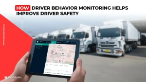
GPS Tracker Function
GPS Tracker is an electronic device used to track location, movement, and other information about an object or vehicle. GPS Tracker functions can vary depending on the type and purpose of use, and not all of them are related to security or eavesdropping. Here are some common GPS Tracker functions:
Anticipate Theft
GPS Trackers are often used to track vehicles or valuable items, such as cars, motorbikes, or construction equipment. This allows owners to anticipate or detect theft and track the location of their assets if they are stolen.
View Travel History
GPS Tracker can record and store travel history data, including route, distance, and travel time. This is useful for monitoring the activity or travel of a particular vehicle or person.
Detect the Nearest Police Station
Some GPS Tracker applications designed for personal security or safety can provide information about the location of the nearest police station or other emergency facilities in an emergency situation.
Estimating Weather Conditions
Some GPS Trackers may have the ability to integrate weather data and provide information about current weather conditions or recent weather warnings at a specific location.
However, it is important to remember that wiretapping conversations in a car using a GPS Tracker without permission is illegal and violates an individual’s privacy. Use of a GPS Tracker must always be carried out in compliance with applicable laws and regulations.
Apart from the functions above, GPS Tracker is also used in various other applications, such as:
- Vehicle and Logistics Monitoring: To track the movement of trucks, ships, or business vehicle fleets.
- Navigation and Directions: To provide directions and routes to the driver.
- Health Monitoring: To track an individual’s physical activity and health, like a fitness tracker.
- Pet Monitoring: To track pet location and activities.
- Inventory Monitoring: To track stock of goods in a warehouse or store.
- Personal Security: For personal security, such as tracking children or vulnerable family members.
- Monitoring in Sports and Competitions: To track the movement of athletes or vehicles in sports competitions.
GPS Tracker types and capabilities may vary, so it is important to choose one that suits your goals and needs while complying with applicable laws.
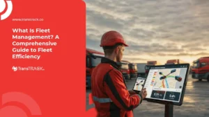
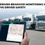
Improve fleet safety with TransTRACK
In pursuing operational efficiency and optimizing fleet management, integrating a third-party GPS Tracker with a Fleet Management System (FMS) such as that offered by TransTRACK can be a very useful solution. With the ability to incorporate real-time GPS data and advanced features from third-party GPS Trackers into your TransTRACK FMS system, you will unlock new opportunities for better fleet management.
Integrating third-party GPS Trackers with FMS TransTRACK can help your business increase operational efficiency, reduce costs, and improve fleet safety. So, if you’re looking for a way to take a step towards better fleet management, consider integrating a third-party GPS Tracker with TransTRACK’s FMS TransTRACK solution. With this, you will have complete control over your fleet and can optimize your overall business operations.


Topic :