Bahasa Indonesia
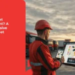
Which Ship Tracking Tool is Better? Get to know TransTRACK’s Hybrid GPS!
Posted on December 25, 2023 by Nur Wachda Mihmidati
Amidst the never-ending dynamics of the sea, ship tracking has become a crucial factor in maintaining the safety, efficiency, and sustainability of the maritime industry. In a major step towards digital transformation, ship tracking technology is increasingly becoming a key cornerstone for ship owners and fleet managers. In this context, TransTRACK’s Hybrid GPS Tracker technology has become a leading choice, opening the door to smarter, real-time, and globally connected monitoring.
In this article, we will explore the advantages of Hybrid GPS Tracker technology, an innovative solution that takes vessel monitoring to a new level. From real-time monitoring capabilities to hybrid connectivity that utilizes satellite signals and Global SIM cards, let’s dive into how this technology is charting a new course in fleet management and shipping security. Also, how solar charging and offline media options provide extra reliability amidst diverse environmental challenges.
With TransTRACK, let’s explore how Hybrid GPS Tracker technology is carving a new narrative for the shipping industry. A journey towards smarter, more efficient and customized ship monitoring.
Ship Tracking Tools
There are several types of ship tracking devices used to monitor and track the movement of ships at sea. Some commonly used technologies include:
AIS (Automatic Identification System)
AIS is an automated system used to track the position of ships. Every ship above a certain size is required to install an AIS device. These devices transmit information such as vessel identification, position, speed, and course to other vessels and shore stations.
VMS (Vessel Monitoring System)
VMS is used to track and manage commercial fishing vessels. These systems utilize GPS technology to track the vessel’s position and transmit information to shore stations. VMS is commonly used to monitor fisheries activities and ensure compliance with regulations.
Radar
Radar is a technology that has long been used to track objects at sea, including ships. Radar systems use radio waves to detect and track a ship’s position, as well as provide information on distance and direction.
Satellite
Ship tracking systems use satellites to monitor the movement of ships around the world. This technology can provide accurate and extensive information about a ship’s position, and can be used for remote monitoring.
Integrated Tracking Systems
Some systems use a combination of technologies, such as AIS, radar and satellite, to provide comprehensive monitoring of vessels at sea.
GPS (Global Positioning System)
GPS is one of the main technologies used in ship tracking. GPS utilizes satellites to determine position, speed, and time with high accuracy. Many modern ships are equipped with GPS receivers connected to their navigation systems.
GPS systems allow ships to transmit their position information in real-time, and this can be used in a variety of applications, including navigation, marine traffic monitoring, fleet management, and maritime security. Some ship tracking systems integrate GPS data with information from other technologies, such as AIS and radar, to provide more complete and accurate monitoring.
The choice of ship tracking tools may vary depending on the monitoring needs and purpose. For example, governments and maritime regulatory agencies often use a combination of technologies to monitor vessel traffic, while shipping companies may use tracking systems that are customized to their operational needs.
Features of GPS for Boats
GPS for boats usually comes with various features to help with navigation, monitoring, and security. Here are some of the common features found in shipboard GPS:
Mapping and Navigation
GPS for boats can provide digital mapping and navigation assistance. This includes electronic nautical charts that display information such as water depth, recommended routes, ports, and other marine landmarks.
Speed and Direction Monitoring
GPS allows vessels to track speed and direction of travel in real-time. This can help ship captains to optimize routes, estimate arrival times, and make better navigation decisions.
Waypoints
Users can set reference points (waypoints) on the map as navigation guides. This is useful for planning routes and ensuring the vessel follows the desired path.
Alarms and Warnings
Shipboard GPS is often equipped with automatic alarms and warnings, such as warnings of approaching shallow waters, excessive speed warnings, or warnings if the ship goes off the set course.
AIS Integration
A ship’s GPS system is often integrated with AIS to get more information about the surrounding ships. This helps in avoiding collisions and improving safety at sea.
Engine Performance Monitoring
Some shipboard GPS can integrate information from the ship’s engine sensors, providing better engine performance monitoring and maintenance.
Fuel Monitoring
GPS systems can assist in the monitoring of vessel fuel consumption, helping fleet management to optimize fuel efficiency and reduce emissions.
Satellite Connection
Some boat GPS can connect to satellite services to ensure a stable and reliable GPS signal, especially in remote or offshore areas.
Trip Data Recording
GPS systems can record trip data that can be used for further analysis, performance monitoring and record maintenance.
This feature may vary depending on the model and brand of vessel GPS device used. Modern vessels often utilize integrated navigation systems that include GPS, AIS, and various other sensors to provide holistic monitoring.
Key Features of TransTRACK’s Hybrid GPS on Vessel
The advantages of the Hybrid GPS Tracker from TransTRACK that you mentioned have several features that can provide significant benefits in monitoring and tracking ships and other vehicles. Here is a more detailed explanation of each of these advantages:
Real-Time Monitoring
- Benefits: Allows users to track the location of vehicles directly and accurately in real time.
- Applications: Useful for fleet management, security monitoring, and efficient monitoring of vehicle movements.
Hybrid Connection
- Benefits: Provides flexibility in tracking by using satellite signals and global SIM cards.
- Applications: Supports tracking in remote areas or out of range of traditional cellular networks.
Comprehensive Report
- Benefits: Provides comprehensive reports on the tracking activities of ships and other fleets, including routes, speeds, stop times, and other statistics.
- Applications: Useful for vehicle performance analysis, more efficient route planning, and operational activity monitoring.
Solar-Powered Charging Option
- Benefits: Utilizes solar energy to charge the device autonomously, reducing dependence on external power sources or backup batteries.
- Applications: Ideal for vehicles operating in remote areas or away from traditional power sources.
Offline Media Data Option
- Benefits: Allows the device to store tracking data when there is no connection, and then transfer the data when a connection is available.
- Application: Useful when the vehicle is in an area with limited network, ensuring data is still recorded and can be accessed later.
The combination of these features in TransTRACK’s Hybrid GPS Tracker creates an advanced and reliable vessel tracking solution, with the ability to adapt to a wide range of operational and environmental conditions. The ability to combine satellite and Global SIM Card signals also increases the robustness of the device in situations where conventional signals may be inconsistent.
In this era of intense competition in the shipping and fleet management industry, advanced monitoring technology is key to achieving maximum efficiency and safety. TransTRACK’s Hybrid GPS Tracker has proven itself to be a reliable solution for vessel tracking needs with unrivaled features.
With real-time monitoring capabilities, extensive hybrid connectivity using satellite signals and Global SIM cards, and comprehensive reports, the device enables ship owners and fleet managers to better optimize their operations.
Unique features, such as the solar charging option, add to the device’s durability in often hard-to-reach environments. Meanwhile, the offline media option provides the flexibility to store vessel tracking data when there is no connection and then transfer the information when a connection is available again.
By adopting TransTRACK’s Hybrid GPS Tracker technology, the shipping industry can improve operational efficiency, enhance vessel safety, and keep their vehicles connected in a variety of conditions. Investing in this solution not only results in precise monitoring, but also provides higher competitiveness in the face of dynamic maritime sector challenges. As such, TransTRACK represents a leading step in shaping the future of integrated and resilient ship monitoring.
Recent Post


Topic :
gps trackerhybrid gpstechnology