English
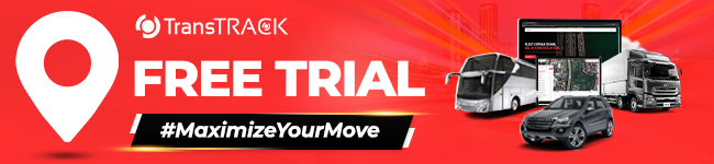
Geofence, Lacak Lokasi Armadamu Untuk Manajemen yang Lebih Aman!
Diposting pada Mei 27, 2025 oleh Nur Wachda Mihmidati

Geofence menjadi layanan yang sangat penting untuk bisa dinikmati oleh pengguna jalan. Lalu, bagaimana bisa teknologi menjadi sangat penting? Bagaimana cara kerjanya? Kalian bisa simak artikel dari TransTRACK berikut ini ya untuk mengetahui segala manfaatnya!
Pengertian Geofence
Geofence adalah layanan berbasis lokasi di mana aplikasi atau perangkat lunak lain menggunakan GPS, RFID, Wi-Fi, atau data seluler untuk memicu tindakan yang telah diprogram saat perangkat seluler atau tag RFID masuk atau keluar dari batas virtual yang diatur di sekitar geografis. lokasi, yang dikenal sebagai geofence.
Bergantung pada bagaimana geofence dikonfigurasi, hal itu dapat meminta pemberitahuan push seluler, memicu pesan teks atau peringatan, mengirim iklan yang ditargetkan di media sosial, memungkinkan pelacakan armada kendaraan, menonaktifkan teknologi tertentu atau mengirimkan data pemasaran berbasis lokasi.
Beberapa geofence disiapkan untuk memantau aktivitas di area aman, memungkinkan manajemen untuk melihat peringatan saat seseorang memasuki atau meninggalkan area tertentu. Bisnis juga dapat menggunakan geofencing untuk memantau karyawan di lapangan, mengotomatiskan kartu waktu, dan melacak properti perusahaan.
Jenis-Jenis Geofence
Dalam dunia pelacakan dan manajemen kendaraan modern, Geofence memainkan peran penting dalam meningkatkan efisiensi, keamanan, dan pengawasan operasional. Geofence adalah batas virtual yang dibuat pada peta digital untuk memantau pergerakan objek seperti kendaraan, alat berat, atau bahkan personel. Saat objek melintasi batas tersebut, sistem akan memberikan notifikasi atau memicu tindakan tertentu.
Seiring berkembangnya teknologi, jenis-jenis geofence pun semakin beragam dan disesuaikan dengan kebutuhan industri. Berikut adalah tiga jenis utama geofence yang umum digunakan:
1. Geofence Statis
Geofence ini memiliki koordinat tetap dan tidak berubah-ubah. Umumnya digunakan untuk lokasi permanen seperti kantor, gudang, atau titik distribusi.
Contoh penggunaan: memantau waktu kedatangan dan keberangkatan kendaraan dari suatu lokasi tertentu.
2. Geofence Dinamis
Geofence ini bergerak mengikuti objek yang dipantau. Radius geofence tetap, namun posisinya berubah sesuai lokasi kendaraan atau alat berat.
Contoh penggunaan: menjaga jarak aman antar kendaraan dalam konvoi atau memantau area kerja bergerak.
3. Geofence Adaptif
Merupakan geofence cerdas yang dapat berubah bentuk dan ukuran secara otomatis berdasarkan data historis, perilaku objek, atau kondisi lingkungan.
Contoh penggunaan: menyesuaikan zona aman berdasarkan waktu operasional atau mengidentifikasi aktivitas tidak biasa.
Manfaat Geofence Dalam Manajemen Armada kendaraan
Geofence, yang dikenal sebagai “pagar” virtual, mencakup batas area tertentu di peta, dan kita dapat menggunakannya untuk mengetahui kapan aset armada memasuki atau keluar dari area tersebut. Sistem mengirimi kita peringatan agar kita selalu mendapat informasi terbaru. Apa saja manfaat geofencing?
Menghentikan Pencurian
Karena kita memiliki wawasan yang lebih luas tentang keberadaan armada, geofence akan memberi kita pengetahuan tentang pengoperasian armada kita. Kemudian kita juga dapat mengidentifikasi dan mencegah pencurian, dan dalam beberapa kasus, geofencing menurunkan premi asuransi.
Hal ini bisa terjadi karena bagaimana teknologi mencegah kerusakan peralatan dan tuntutan hukum akibat kecelakaan mobil. Alhasil, perusahaan asuransi mobil rela menurunkan premi.
Faktanya, pencegahan pencurian bahan bakar melalui pembatasan wilayah bahkan dapat menghemat hingga $400.000, seperti yang ditemukan oleh salah satu perusahaan yang tidak percaya. Saat kita melihat kendaraan keluar dari geofence, kita dapat melaporkannya lebih cepat, sehingga lebih mudah membawa penjahat untuk diadili.
Mempekerjakan Aset Lebih Efektif
Pergerakan kendaraan di dalam dan di luar geofence akan membantu kita melihat penggunaan kendaraan yang tepat dan tidak tepat. Kadang-kadang karyawan akan menghabiskan sebagian besar waktu mereka menganggur di luar geofence, atau mereka akan mengambil rute yang tidak disesuaikan yang dapat memanfaatkan aset armada kita untuk penggunaan pribadi.
Kita ingin mengidentifikasi dan menghilangkan pemborosan yang mahal ini dari perjalanan pribadi dan pengeluaran armada.
Meningkatkan Tingkat Produktivitas Kita
Seiring dengan jaminan penggunaan aset yang tepat, geofencing menunjukkan keefisienan. Manajer armada dapat memverifikasi dan memastikan karyawan mengikuti rute terbaik untuk menurunkan biaya bahan bakar, dan geofencing memastikan bahwa karyawan menggunakan waktu mereka dengan bijak. Jika terjadi keadaan darurat, kita dapat mengidentifikasi orang terbaik untuk diajukan guna merespons dengan lokasi GPS real time. Kita tidak lagi harus menindaklanjuti dengan panggilan telepon yang sia-sia di mana karyawan kita mungkin atau tidak mengatakan yang sebenarnya. Sebaliknya, kita melihat peta dan mengambil tindakan berdasarkan apa yang kita lihat.
Meningkatkan Kualitas Komunikasi
Pernah berharap kita dapat meminimalisir komunikasi manajer-ke-pengemudi armada? Untuk melakukan ini, kita dapat menggunakan solusi pelacakan armada GPS. kita tidak lagi harus melakukan konfirmasi manual setelah karyawan tiba di lokasi kerja.
Alih-alih, peringatan otomatis dikirimkan langsung ke ponsel kita begitu pengemudi tiba, dan kita selalu dapat menggunakan ini sebagai referensi untuk lokasi real-time dengan peta.
Lebih Aman
Karena tingkat pengetahuan yang lebih tinggi yang diberikan oleh teknologi ini, kita tahu kapan dan di mana pengemudi kita berada sepanjang hari. Pengetahuan ini menambah keamanan di jalan karena jika terjadi keadaan darurat seperti kecelakaan mobil atau bahaya lainnya, kita dapat menemukannya dengan cepat. kita meningkatkan tingkat visibilitas dan meningkatkan keamanan dalam prosesnya.
Data yang Lebih Baik
Setelah kita menerapkan sistem ini, pada akhirnya kita akan mendapatkan akses ke banyak data berharga yang dapat kita gunakan untuk meningkatkan armada kita. Misalnya, kita dapat menggunakannya untuk menghasilkan wawasan atau menggunakannya untuk memahami armada mana yang memiliki performa terbaik dan alasannya. kita kemudian dapat membentuk kebijakan untuk meningkatkan kinerja di seluruh perusahaan.
Cara Kerja Geofence
Untuk menggunakan geofence, administrator atau pengembang harus terlebih dahulu menetapkan batas virtual di sekitar lokasi tertentu dalam perangkat lunak yang mengaktifkan GPS atau RFID. Ini bisa sesederhana lingkaran yang digambar 100 kaki di sekitar lokasi di Google Maps, seperti yang ditentukan menggunakan API saat mengembangkan aplikasi seluler. Geofence virtual ini kemudian akan memicu respons saat perangkat resmi masuk atau keluar dari area tersebut, seperti yang ditentukan oleh administrator atau pengembang.
Geofence paling sering didefinisikan dalam kode aplikasi seluler, terutama karena pengguna harus ikut serta ke layanan lokasi agar geofence berfungsi. Jika kita pergi ke tempat konser, mereka mungkin memiliki aplikasi yang dapat kita unduh yang akan memberikan informasi tentang acara tersebut. Atau, pengecer mungkin membuat geofence di sekitar gerainya untuk memicu peringatan seluler bagi pelanggan yang telah mengunduh aplikasi seluler pengecer. Dalam kasus ini, geofence yang dikelola oleh retailer diprogram ke dalam aplikasi, dan pengguna dapat memilih untuk menolak akses lokasi untuk aplikasi tersebut.
Geofence juga dapat diatur oleh pengguna menggunakan kemampuan geofencing di aplikasi seluler mereka. Aplikasi ini, seperti Pengingat iOS, memungkinkan kita memilih alamat atau lokasi tempat kita ingin memicu peringatan tertentu atau pemberitahuan push. Ini disebut perintah “jika ini, maka itu”, di mana aplikasi diprogram untuk memicu tindakan berdasarkan tindakan lainnya. Misalnya, “Jika saya berada lima kaki dari pintu depan saya, nyalakan lampu saya.” Atau kita dapat meminta aplikasi pengingat untuk mengirimkan peringatan setelah kita mencapai lokasi tertentu.
Geofencing bukan hanya untuk aplikasi seluler – itu digunakan untuk mengontrol dan melacak kendaraan di industri perkapalan, ternak di industri pertanian dan – kita akan melihat topik ini muncul dalam diskusi drone. Hampir setiap drone diprogram sebelumnya untuk mengakomodasi geofencing, yang biasanya dipasang di sekitar bandara, tempat terbuka, dan bahkan Gedung Putih. FAA dapat mengatur geofences drone ini berdasarkan permintaan – beberapa penghalang akan menghentikan drone di udara, sementara yang lain akan memicu pesan peringatan kepada pengguna. Beberapa geofences drone akan meminta otorisasi pengguna – sebuah proses yang mengikat identitas pengguna ke drone mereka – sehingga penegakan hukum dapat melacak drone tak berawak.
Cara Menerapkan Geofencing di Armada Kita
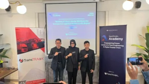
Lalu, bagaimana cara menerapkan geofencing ini pada armada milik kita? Cara menerapkannya hanyalah, kalian tidak perlu repot-repot dan bingung bagaimana cara memasangnya. Sebab, kalian hanya perlu memiliki produk dari TransTRACK, dan geofence ini secara otomatis telah berada pada armada yang kalian pakai.
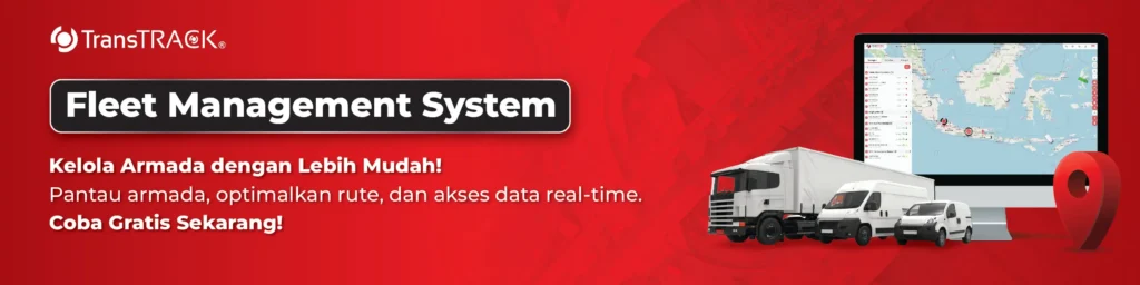
Bukan hanya geofence, kalian juga akan mendapatkan fitur lainnya seperti fuel sensor, immobilizer, proteksi ganda, pembatas kecepatan, maupun fitur-fitur lainnya. Gunakan Fleet Management System untuk manajemen armadamu yang lebih baik lagi!
Postingan Terbaru

Topik :